|
|
|

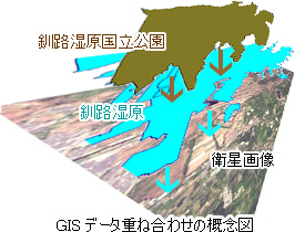
Have you ever heard the terminology called GIS? This is the abbreviation of "Geographical Information System." Conceptually speaking, it is possible to simply overlap the map file (layer) to evaluate as long as it has objective positional information such as longitude/latitude.
By utilizing GIS on this webpage, it is aimed to open and share various information about Kushiro wetland and the restration project efficiently. |
|
 |
|
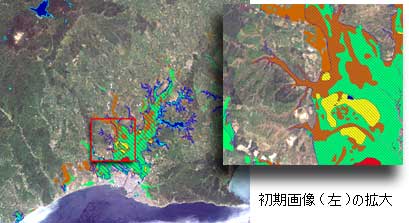
| The technorogy to open these GIS data via World Wide Web is called Web GIS. With this system, literally anyone who has just ordinal access to internet is able to have access to various GIS data. It has large possibility to enhance ordinal one-way open information system to two-way open information, which would offer more flexibility and operatability to look for wanted information to users. |
|
 |
|
| One of the characteristics of GIS compared to the static picture is the operatability. The most simple operation may be scaling up and down function. Not like conventional pictures, these maps would not change the quality of view when the scales up/down. |
|
 |
|
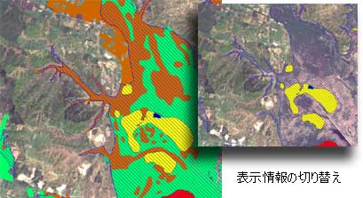
| Furthermore, user can choose the data to want to be shown from the given selection. |
|
|
|
 |
|
|