| Kushiro Wetland from IKONOS | ||||||||||||||||||||
 |
||||||||||||||||||||
|
<Description>
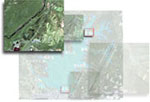
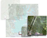
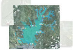
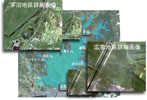
With amazing development of technology, we are able to capture so much detail of ground from universe. Several satelites are working to take pictures of ground currently, and IKONOS is one of those. IKONOS has such a great ability to capture small objectives. Here, we have two IKONOS-pics; one covers all over the Kushiro wetland with the resolution of 2m, and the others cover just Touro-Kayanuma and Hirosato but the resolution is 1m. |
||||||||||||||||||||
|
You can access to WebGIS from pictures below.
|
||||||||||||||||||||
| Other servicies of this page mainly utilize satelite pics from Landsat, whose resolution is about 30m. Let's try to compare IKONOS and Landsat, and will see how small IKONOS are able to capture. Since some satelits, such as IKONOS, are able to achieve such high-level resolutions, pics from those are often used for various purposes, such as remote-sensing. |
||||||||||||||||||||
|
<IKONOS Pics for Kushiro Wetland − Explanatory Note>
|
||||||||||||||||||||